
Haverford Township ZIP Code Coverage
Haverford Township is a legal municipality in Delaware County, while ZIP codes are USPS delivery geography. Six current ZIP-coded post offices serve portions of the Township: Ardmore, Bryn Mawr, Drexel Hill, Haverford, Havertown, and Wynnewood. Their delivery areas also reach neighboring municipalities. The table supplies usable locality context, not a claim that a whole ZIP falls inside the Township. Confirm a particular house number with USPS before using a ZIP in a property or historical search.
| ZIP | Areas Covered | Post Office | Notes |
|---|---|---|---|
| 19003 | Township portion of the Ardmore delivery area; Ardmore Park and South Ardmore are historic clues. | Ardmore Post Office | Shared with neighboring municipalities. |
| 19010 | Township portion of the Bryn Mawr delivery area on the Main Line side. | Bryn Mawr Post Office | A Bryn Mawr mailing address is not a municipal test. |
| 19026 | Township portion of the Drexel Hill delivery area. | Drexel Hill Post Office and Pilgrim Gardens station | Shared delivery geography. |
| 19041 | Haverford delivery portion, including the Haverford and Haverford College area as a geographic clue. | Haverford Post Office | The post-office area also includes part of Lower Merion. |
| 19083 | Havertown delivery area, a principal central and western mailing label. | Havertown Post Office | Smaller than the Township and extends into Upper Darby and Lower Merion. |
| 19096 | Township portion of the Wynnewood delivery area. | Wynnewood Post Office | Shared postal geography at the Township edge. |
The Historical Society's post-office timeline documents the current service labels and the postal history behind them.
Haverford Township Boundary Records
Havertown is not a municipality. The Historical Society says it became a postal-delivery name on January 1, 1946, and that its postal area is smaller than Haverford Township. Parts of the Havertown area reach Upper Darby Township and Lower Merion Township. At the same time, portions of Haverford Township receive Ardmore, Bryn Mawr, Drexel Hill, Haverford, or Wynnewood mail. Some post-office buildings that serve Township addresses are outside the Township.
Postal boundary check. Treat a ZIP as a delivery clue. Confirm the exact address with USPS, then use the County parcel record to identify the municipality and situs address.
This distinction prevents a common false match. A Haverford postal address can overlap Lower Merion, and Haverford College is mostly in the Township but extends into Lower Merion with a Montgomery County address. The Haverford and Havertown research note explains why the names cannot be used interchangeably.
Validating Haverford Township ZIP Codes
USPS ZIP Code Lookup is the authoritative validation step. It checks postal delivery information, not whether a named person or company is at an address. Use the full street address where possible, because a city-and-state lookup can return a list tied to a city name rather than settling a municipal-boundary question. Save the returned ZIP as a mailing detail, then retain the County parcel identifier separately when the record trail concerns a property.
| ZIP Code by Address | Requires street address plus city and state, or street address plus ZIP. |
|---|---|
| ZIP Code by City and State | Requires City and State and returns a list tied to that city name. |
| Cities by ZIP Code | Requires the ZIP Code and returns cities associated with it. |
| What the result means | It validates delivery geography, not residency, ownership, or the Township boundary. |
The USPS ZIP Code Lookup is the source for these three modes.
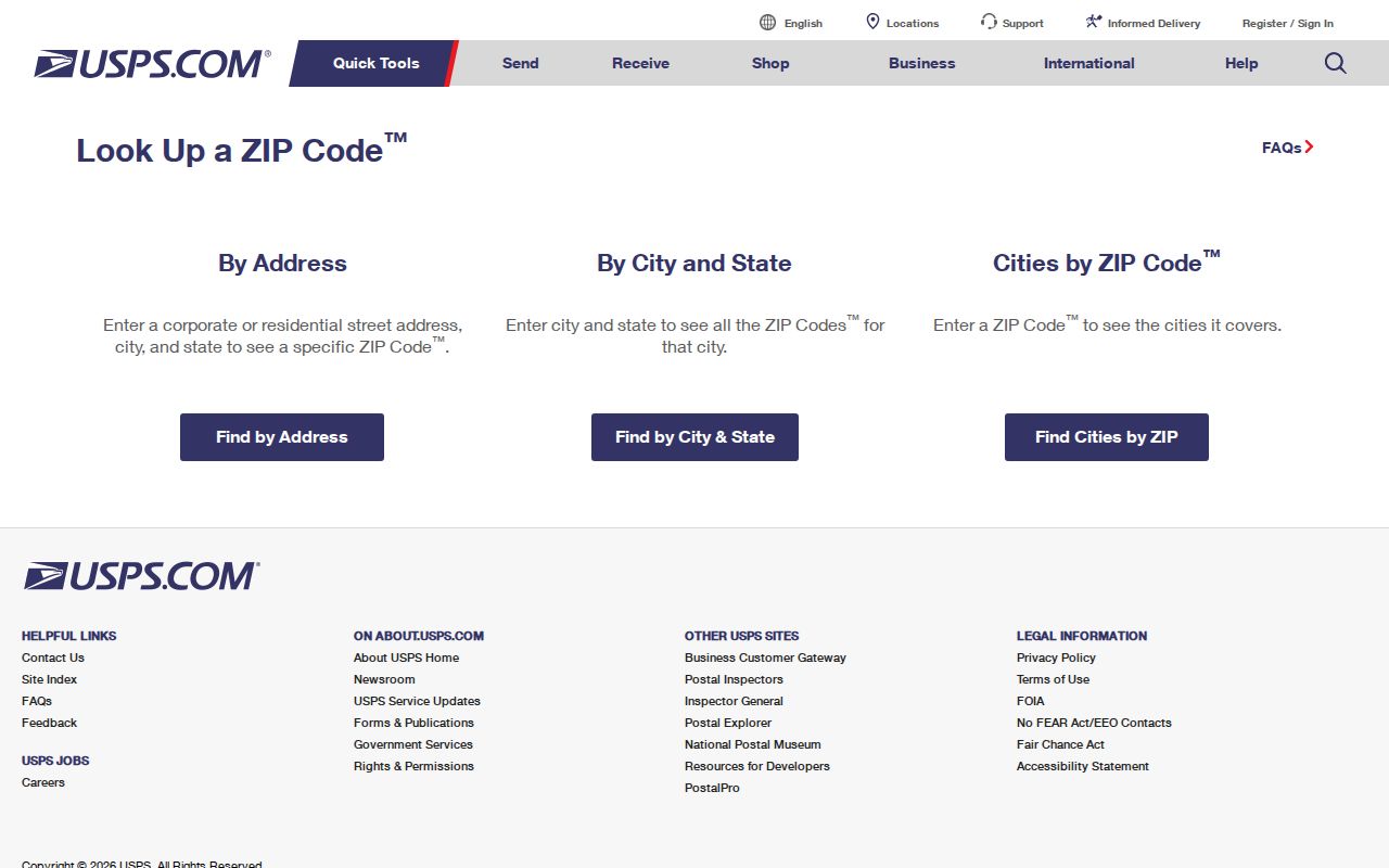
The USPS screen is the first check for a postal address, after which County and Township records answer the different question of jurisdiction or parcel identity.
Haverford Township ZIP Code Directory Limits
No verified official local portal inspected for this project exposes a ZIP filter that returns a ZIP-wide roster of Haverford Township properties, permits, residents, or voters. The Township's known-permit lookup has no ZIP field. It requires both a selected Parcel Address and a Reference Id. The Historical Society's local directory material is organized by Township or locality, not as a ZIP dataset. USPS lookup validates an address; it is not a people search.
Myth: Entering 19083, 19041, or another local ZIP will not produce a complete household list. Renter, protected-address, sealed, and record-specific limits mean that no local ZIP result can establish every current occupant.
The County real-estate portal and GIS viewer should not be described as ZIP roster tools unless their live interfaces later document that capability. Their reliable role here is the exact-address and parcel trail.
Finding a Haverford Township Address by ZIP
A ZIP can narrow the postal question, but an exact address carries the research forward. Begin with USPS to validate delivery information. Next, search the Delaware County real-estate system by address and preserve the Parcel ID, situs address, municipality, legal-description text, and current-owner display where available. The Recorder directs users to obtain that Parcel ID before deed research. The property route documents land and current assessment data, not a complete list of everyone at the address.
- Validate the exact street address through USPS rather than assuming a postal city identifies the Township.
- Use the County property address search to establish the parcel and municipality.
- Record the Parcel ID and legal description before searching recorded documents.
- Use the Recorder's public-access route for a deed or recording trail when ownership is the question.
- For a named street after the ZIP is narrowed, use the By Street directory for the address-based workflow.
The official Delaware County Real Estate/Tax System and the Recorder's Public Access Sites are the two linked steps in that chain. Note: A mailing address can differ from the parcel's physical situs address, so record both without treating them as the same field.
Haverford Township Postal Records
Postal and parcel terms solve different problems. The County property record uses a situs address for the physical site, while a mailing address is where tax correspondence goes. The legal description and Parcel ID connect assessment and recorded-land records even if a street name, number, or postal label changes. Keep those terms in the research notes rather than replacing them with a ZIP result.
- ZIP Code
- A USPS delivery-area code used to route mail; it is not a municipal boundary.
- ZIP+4
- An added USPS delivery segment used with the base ZIP for more specific mail sorting.
- PO Box ZIP
- A ZIP associated with post-office boxes rather than a claim about every street delivery in an area.
- Unique ZIP
- A ZIP assigned for a particular organization or delivery use, not a general Township boundary.
- Carrier route
- A mail-delivery grouping; it does not establish property jurisdiction or household membership.
The local rule is simple: use USPS for delivery validation, the assessment record for parcel identity, and the Recorder for recorded-land history.
Haverford Township Postal History
Historical sources use a different postal vocabulary. The timeline records Haverford from 1830-1882, Manoa from 1882-1915, Llanerch from 1897-1918, Upper Darby from 1918-1929, and Llanerch Branch from 1929-1945. The present Havertown service developed from the Llanerch and Upper Darby sequence and became a branch of Upper Darby in 1946. A Manoa neighborhood branch operated from 1957 to 2011.
Insider tip: When a dated newspaper or directory does not say Havertown, search the old post-office label and present street name together. That helps preserve address continuity without treating a modern ZIP as an old locality.
Historic locality labels also include Brookline and other neighborhood names. They are research clues, not postal boundaries or proof of a present address.
Haverford Township Map Records
Historic maps supply a second address check when the postal label has changed. The Historical Society inventory includes material from 1848, 1870, 1875, 1880, 1892, 1909-10, Township Engineer maps from the 1920s and 1930s, 1925 water and sewer plans, 1925-40 Sanborn maps, a 1946 street and business occupancy atlas, and a 1961 Main Line property atlas. These sources can show lot lines, buildings, road alignments, and development names. They cannot establish a person's residence.
The County's Historic Maps page identifies historic-map resources and research contacts.
A dated atlas is most useful when it tests whether the street or structure existed in the directory or census period being studied.
Haverford Township Address Records
When a ZIP result and an older source conflict, use the custodians in order rather than choosing the label that looks familiar. First validate the delivery address with USPS. Second, establish the County parcel's municipality and situs address through the property system. Third, use the Parcel ID and legal description to locate recorded deeds. Finally, request Township permits, plans, or zoning material by a narrow address and date range when the question concerns a building or land-use history. Each source answers a different part of the address question.
The Township Planning and Zoning Department administers the Zoning Ordinance and Subdivision and Land Development Ordinance and provides interactive zoning and subdivision maps. The research did not identify an E911 addressing authority, a Townshipwide numbering grid, or a documented Townshipwide renumbering project. Preserve the exact historic spelling, neighborhood or post-office label, and Parcel ID before normalizing an address to a current ZIP format.
The Township's Planning and Zoning route is the municipal contact point for subdivision and land-development questions. Note: The known-permit screen needs both a selected Parcel Address and Reference Id, so it is not a broad ZIP search.